Valley Line LRT/ Valley Line West | ?m | ?s | City of Edmonton

Delayed Valley Line Southeast LRT tracking toward late 2021 opening as part of city's $1-billion 2021 construction season

Author of the article Dustin Cook

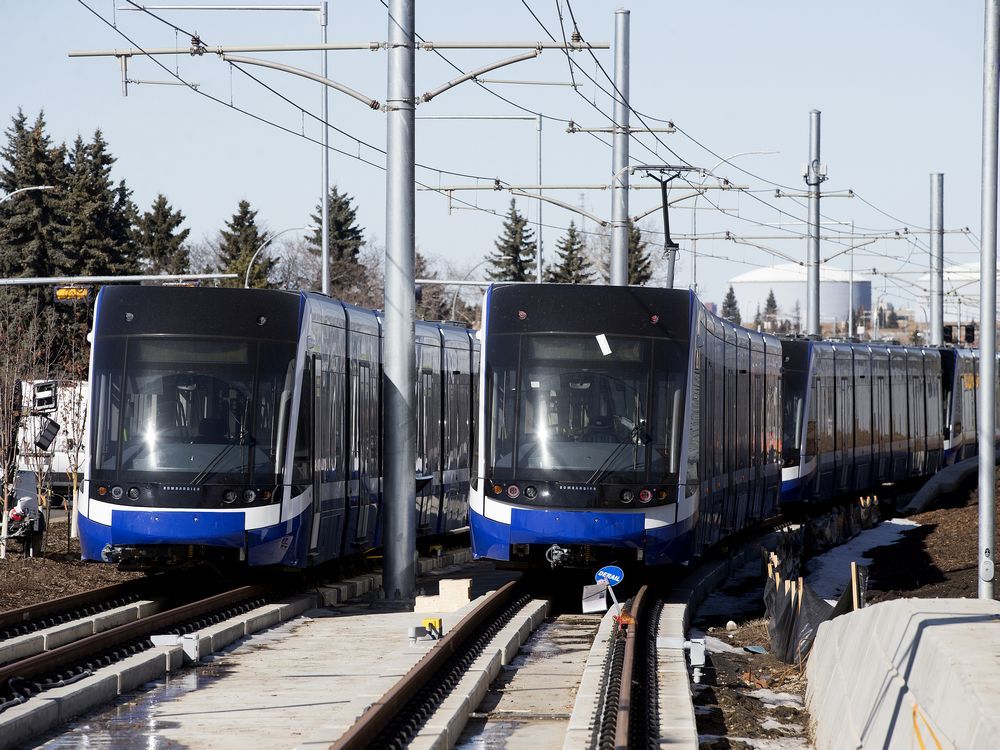
The delayed 13-kilometre Valley Line Southeast LRT from Downtown to Mill Woods is tracking toward a “late 2021” opening.

Adam Laughlin, the city’s deputy city manager of infrastructure, provided an update on the timeline Tuesday while unveiling the city’s $1-billion construction plan for this year.

Initially expected to open last December, Laughlin said the $1.8-billion first phase of the Valley Line is nearing the end of construction and will then need to go through rigorous commissioning and testing before it opens to residents. The line is being constructed by TransEd, a consortium of companies, who will also operate it.

The project hit a roadblock in early 2018 after a car-sized concrete slab was found in the North Saskatchewan River during construction of the new Tawatinâ Bridge. At the end of February, the LRT line was at 89 per cent completion.

The onus is on TransEd to complete the line and ensure it meets all the requirements under the project agreement, Laughlin said.

 
20210505_081536.jpg
20210505_081327.jpg20210505_081052_HDR.jpg20210505_081248_HDR.jpg20210505_081042_HDR.jpg20210505_081530_HDR.jpg20210505_081009.jpg
Taken May 5, 2021
I am glad this is now fully operational. It seems better organized than the previous transit centre. I also like that the have a map of the transit centre inside so you don't have to wander looking for your bus stop.
 
Taken May 5, 2021
I am glad this is now fully operational. It seems better organized than the previous transit centre. I also like that the have a map of the transit centre inside so you don't have to wander looking for your bus stop.
thanks for sharing photos of this! I was there recently, but my photography skills failed me, and i couldn't capture how great this thing looks. these photos do it justice!
It's light, airy, and easy to navigate. It's huge, it reminds me of the big bus stations at Disney World (not a good thing by default imo, but here it really works) and the new 'transit street' model with buses in the middle seems easier to navigate than the old island platforms; sightlines are clearer. I also love the building. the zigzag roof is a fun arch statement, without being overbearing. the concrete service block fits in nicely, and the glazing everywhere else is pleasant and makes it feel safer to be walking through. I love this thing, it makes me actually want to go to Millwoods!
 
This may be a bit of an overcorrection from the iPhone photos in my last post, but here's a stitched photo to give a higher resolution look at the south side of the Tawatinâ Bridge from the same vantage point, as well as a wider view. (Here's a link to a full-res version, I couldn't upload it here due to the size constraints)

I'm also curious, does anyone have any theories for how they'll be doing the portion of the walkway over the river? The rolling platform they've built (up against the pier in these photos) is obviously a big part of it but I'm not quite sure how they'll get the sections up to it.
IMG_4538.jpg
high res bridge.jpg
 

Back
Top