You are using an out of date browser. It may not display this or other websites correctly.
You should upgrade or use an alternative browser.
You should upgrade or use an alternative browser.
Rossdale
- Thread starter Daveography
- Start date
archited
Senior Member
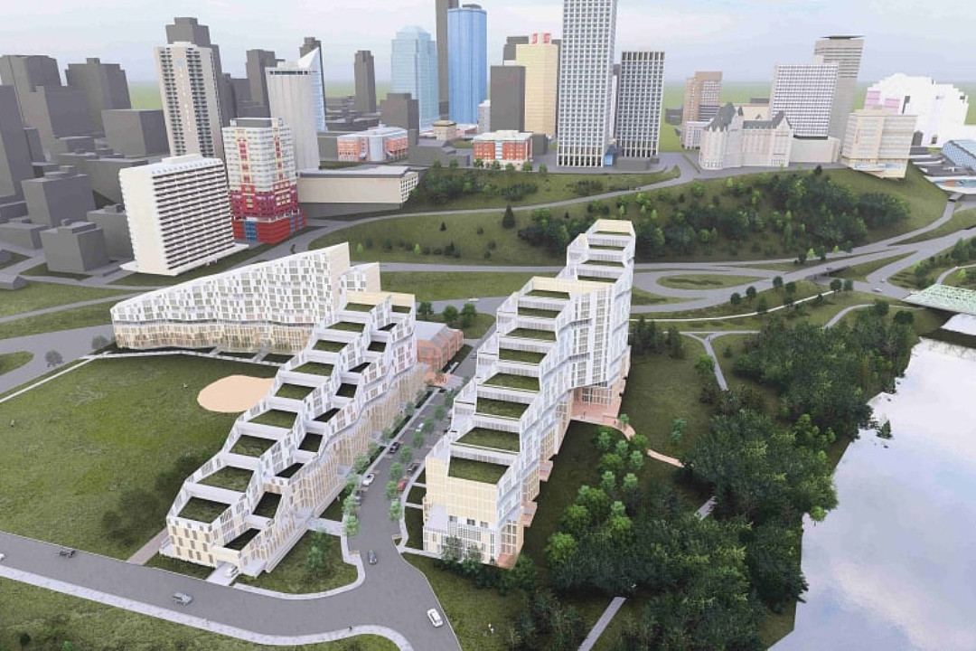
There are 7 edu-socio-economic generators in downtown Edmonton. Two of them are MacEwan University and NorQuest College; another two are the City of Edmonton Civic Government enclave and the Provincial Government enclave; a fifth is the ICE District; a sixth is the Switch (Qualico Development) and the 7th is the Arts District. A potential 8th is WInPEx centred on Rossdale. The City with its jurisdictional powers of free-wheeling Zoning placement could better guide some of these, working to a "supportive" downtown outcome. For example, A post-Secondary Education precinct, as per the attached map:

109th Street -- a street in Edmonton that could easily gain "Boulevard" status -- would then become the spine of both campuses, allowing the more-than-doubling of the footprints of each institution. 102nd Avenue could become a major MUP-way with a bridge spanning 109th Street; ditto 105th Avenue. The 109th Street is wide enough to widen sidewalks, add a bike lane and regenerate a retail/hospitality focus that caters to the University crowd and connects the two MUP-ways with a north-south link.
The complement of this concept to WInPEx is more obvious when you look at 109th Street South of Jasper where it passes through the Provincial Government precinct (another edu-socio-economic generator) and then meets up with the North Saskatchewan River Valley and bounds the western edge of Rossdale. With regards to the Provincial Government precinct and as Alberta's Population and Economy continue to boom the Prov.s will no doubt expand, in terms of services, proportionately. It is the discontinuity of 109th Street by virtue of a dog-legged, substandard-by-modern-standards, uni-purposed (but nonetheless Historically significant) High Level Bridge. Here is where some real opportunity lies that can fix 109th Street's discontinuity, that can repurpose the High Level Bridge, that can add to Rossdale's relevance and that can lend extreme relevance to the new edu-socio-economic generator -- WInPEX!. The Old High Level Bridge would be retrofitted to house a linear high-end retail/hospitality experience featuring the very best that WInPEx has to offer in terms of fashion, art, handicraft, food, and drink in a glass-enclosed bridge deck that showcases the industrial design of the long black bridge. The upper deck could become an MUP-rich and all-season Historic Streetcar pathway in the form of an elevated Linear Park that extends from MacEwan University and NorQuest College south through Old Strathcona to a new 76th Avenue HSR Station. The new Bridge would become a "living bridge" with showcased WInPEx Pavilions and bridge pier supports that are also high-rise residences and hotel structures underscoring all of the Americas from Santa's North Pole to Tierra del Fuego, including the Caribbean.
archited
Senior Member
Considering the potential for a second High-Level "living" bridge that would extend 99th Street from the south side directly across the river valley to meet up with Jasper Avenue just east of the Macdonald Hotel, we can look at what the bridge cross section might look like.

Key:
1. Represents the Gallery Portion of a WInPEx participant's Pavilion -- each Pavilion would be given an assigned deck space on the Living Bridge and would be free to design their building with their own design team within predetermined height, width, and weight restrictions.
2. Each Pavilion would be encouraged to develop an atrium space that could contain some of their home-specific flora and fauna (less aggressive species on the Fauna side, perhaps birds and compatible small mammals and reptiles). They would also be required to provide a inter-connected meandering MUP path suitable for pedestrians and wheelers.
3. A restaurant/tavern space would be provided for the Pavilion occupant that would feature dramatic overlooks of the River Valley.
4. Retail Spaces would also be provided to allow product representation for Indigenous groups related to the Pavilion Nation.
5. continuous end-to-end sidewalks with allowances for patio seating and sidewalk displays relevant to the retail/hospitality ventures that they front.
6. Two lanes of vehicular traffic (each direction) where the curb lane would be dedicated to drop-off zones, automated parking garage podules, delivery vehicle stations and taxi stands; the drive lanes would be monitored remotely and would have periodic pedestrian crosswalks at light-controlled intersections. Structural glass would be a component of the centre divider.
7. LRT high-floor vehicles with stops at major bridge piers which would also be locations for high-rise feature Pavilions for major Nations -- India, Australia/New Zealand, Saudi Arabia/UAE, Israel. The line would connect to the downtown Central Terminal and extend southward to the HSR station on CPKC Rail lands at 76th Avenue.
8. Automated Parking with space for larger vehicles (1/2-ton trucks) on the two upper decks and smaller vehicles on the two lower decks. Vehicle retrieval would be gained by smart-phone apps and by op-specific stations located adjacent to automated parking garage podules.
9. Pavilion participants would be responsible for design, construction (in attendance with a living bridge general contractor), and occupancy of everything above this demarcation line; they would also be responsible for the eatery and retail spaces in similar fashion.
10. The WInPEx Authority would be responsible for design, construction and functional operation of everything else.
Generally, the Living Bridge would have on-deck out-door park spaces breaking up the Pavilion line at key points along the length.
archited
Senior Member
At a key point in the 99th Street Living Bridge, a waterfall feature would visually tie the river to the bridge. This, I believe could be a joint effort by the Australian and New Zealand nations -- there is no specific need to make the structures symmetrical as shown here, but it does make a nicely balanced focal point.

 exaggerated scale Maori Mask --the "river watcher" a face in the waterfall
Water would be pumped up from the North Saskatchewan River, filtered to remove debris, and then piped to various horizontal outlets to create a very stunning visual effect, highlighted at night with staged lighting. The Pavilions on either side would be multi-storied, housing key displays of Indigenous tribes:
The indigenous tribes of Australia, New Zealand, and Tasmania include the Aboriginal Australians, Torres Strait Islanders, and Māori.
Aboriginal Australians:
* Anindilyakwa: From Groote Eylandt, off Arnhem Land, NT
* Arrernte: From central Australia
* Bininj: From Western Arnhem Land, NT
* Gunggari: From south-west Queensland
* Muruwari: From New South Wales
* Luritja (Kukatja): An Anangu sub-group based on language
* Palawa: A term used by Tasmanian Aboriginal people to refer to themselves
* Koori: A term that comes from an Aboriginal dialect called Awabakal
Torres Strait Islanders:
* Kaurareg Nation
Traditional inhabitants of Muralag (Prince of Wales Island), Kirriri (Hammond Island), Ngurupai (Horn Island), and Waiben (Thursday Island):
* Bamaga and Seisia
Two Torres Strait Islander communities on the northern peninsula area of mainland Australia
* Māori
The indigenous Polynesian people of mainland New Zealand
Originated with settlers from East Polynesia, who arrived in New Zealand between roughly 1320 and 1350
The structure would also be a mid-span hotel.
Last edited:
archited
Senior Member
The Bridge Pier Towers could suggest some designs like:
- Inspiration for India Tower -- a condo tower:
 or
or


- Inspiration for Saudi/UAE Tower - a condo tower:
 and Inspiration for Israeli Tower - hotel:
 or
or

and at the LRT Station with conjoined Hotel spanning Jasper Avenue something like:
 or
or

The conjoined span would bridge Jasper Avenue and create a main focal point for the "Living bridge" starting point at the north juncture.
- Inspiration for India Tower -- a condo tower:
- Inspiration for Saudi/UAE Tower - a condo tower:
and at the LRT Station with conjoined Hotel spanning Jasper Avenue something like:
The conjoined span would bridge Jasper Avenue and create a main focal point for the "Living bridge" starting point at the north juncture.
Last edited:
archited
Senior Member
As a passing point the Quarters/Boyle Street area could be re-named SEA-borough (South East Asia) reflecting the nature of the Pavilions there. A lot of cities have a chinatown, none have a SEA-borough.
CplKlinger
Senior Member
Exploring Opportunities - March 2025
During this stage, we commit to using your input in deciding on key elements to be explored in the development of the overall neighbourhood design to align with the Vision for your Neighbourhood Renewal.It’s now time to Explore Opportunities for Rossdale Neighbourhood Renewal.
The project team wants to understand:
- What you like most about Rossdale
- How you experience getting around: Walking, rolling, biking and driving
- How people move in your neighbourhood
- Where people access services and recreation
- How people feel about safety, neighbourliness and sense of community
- What is unique about your neighbourhood
We want to hear from you
To learn more and share your feedback:- Complete the online survey
- Available until Sunday, March 23
- Meet the project team
- Keep an eye out for our Project Team as members come knocking door-to-door
- Evenings of March 10 to 14
- Keep an eye out for our Project Team as members come knocking door-to-door
archited
Senior Member
^ Planners on fire again! The results will hardly be surprising.
ededed
New Member
Just finished the survey. Excited for the renewal. I wrote that I don’t have interest in the indigenous history of Rossdale. Now I’m feeling bad for saying that, but I really don’t have any interest in it. I just want improvements for biking and pedestrians.
Gronk!
Senior Member
I filled out the survey to point where more sidewalks are needed (e.g. east of the Ross Flats apartments). I told them that the beg button to cross 97 Ave needs to be replaced asap because pedestrians have to wait 5 minutes for the crossing signal.
ADob
Active Member
When we go biking or (less often) walking, we will literally take a lengthy detour rather than waiting at that crosswalk. The beg button is a joke and the multilane freeway isn't in any way a pleasant place to wait.I filled out the survey to point where more sidewalks are needed (e.g. east of the Ross Flats apartments). I told them that the beg button to cross 97 Ave needs to be replaced asap because pedestrians have to wait 5 minutes for the crossing signal.
Gronk!
Senior Member

Calls for public engagement: Rossdale rezoning, renewal, green economy
Here are opportunities to inform municipal decisions about rezoning applications, renewals, economic growth, and more.
- Rossdale Neighbourhood Renewal — The City of Edmonton is planning a renewal of Rossdale, including roads, sidewalks, and lights. Residents can let planners know how they move around and experience Rossdale by completing an online survey until March 23
wormwood
Active Member
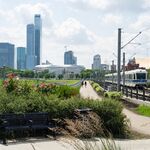
Came across Bricktown Canal in Oklahoma City which was completed in 1999. I can see something similar working well around the old plant and stadium.

IanO
Superstar
That was used as 'the model' for the now (thankfully) defunct canal proposal; a group event went to tour it to bring back ideas.

 globalnews.ca

Proposed canal district in River Valley - Edmonton | Globalnews.ca
A community leader is raising money for a project he thinks will transform a part of Edmonton's River Valley.
thommyjo
Senior Member
Thankfully defunct because? I like the idea personallyThat was used as 'the model' for the now (thankfully) defunct canal proposal; a group event went to tour it to bring back ideas.

Proposed canal district in River Valley - Edmonton | Globalnews.ca
A community leader is raising money for a project he thinks will transform a part of Edmonton's River Valley.globalnews.ca


