News   Apr 03, 2020
 8.1K     3 
News   Apr 02, 2020
 9.1K     0 
News   Apr 02, 2020
 3K     0 

Cycling and Active Transportation in Edmonton

Definitely a needed missing link, especially in that particular spot there is a ton of cross traffic coming from the mall, I would not feel safe biking on that stretch of road.

Also, I didn't even realize that most of 178st had an MUP, it's not shown on Google maps!

View attachment 595222


I have tried to contact Google in the past to update this in another location, they don't seem to respond. I wonder if the city would have some more sway with them?

Maybe you should reply to that email and let them know!
Interesting. Yeah, I wonder how that gets updated. 95ave has also shown bike lanes for years even though it’s been like 7 years since they removed the painted gutters. I’ve had multiple friends end up on 95ave by accident and be terrified.

With the LRT and 95ave completing in a few years, I’d imagine this stretch of 178st becomes VERY well used in 5 years.
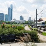
 
Definitely a needed missing link, especially in that particular spot there is a ton of cross traffic coming from the mall, I would not feel safe biking on that stretch of road.

Also, I didn't even realize that most of 178st had an MUP, it's not shown on Google maps!

View attachment 595222


I have tried to contact Google in the past to update this in another location, they don't seem to respond. I wonder if the city would have some more sway with them?

Maybe you should reply to that email and let them know!
As I've began using the active transportation network a lot more since getting an ebike, I've realized that Google is definitely not the best resource for biking. Good overview, but missing a lot. I tend to confirm everything on the City's online map instead - https://gis.edmonton.ca/portal/apps...scoverYEG&id=c1c2fda1accf48788329dd97af32023d
 
I noticed that about Google. I'll use it to generally suggest the fastest route but then add modifications to route it on cycle-friendlier roads and SUPs.

Even then, for example it won't route me to cross 118 Ave at the Coliseum Transit Centre, but I wonder if it was because the pedestrian crossing signal timing was terrible. I sent a 311 request commenting that it was up to a 2-3 minute wait sometimes to cross 118 Ave once the button was pushed and that's since been reduce to 30 second on average, so that might eventually improve the routing algorithm? 311 works sometimes!
 
I agree it is better to use other apps and sources to plan routes, but I think having the bike network properly mapped on Google would be a huge help in getting more people to use it.

I will email the city's active transportation mailbox and see if they can do anything to get it updated.
 
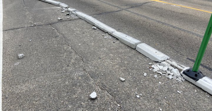
This is so disheartening. The city makes an effort to improve bike and pedestrian access for residents (as well as the quality of life) and some jerks wreck it.
 
ideally, hermitage gets redone and becomes less wide, and has large SUPs on both sides. That’s truly what this corridor needs. But that’s a different cost and budget.

This is just the 95ave on the west end saga again (albeit slightly better separated lanes vs painted bike gutters).

Everyone whined. But 0 peeps from people about 178st getting a wide SUP upgraded from a sidewalk. In recent years.
 
“Some people are having trouble driving around because they’re not used to it,”

:rolleyes::rolleyes:

Clearly the solution now is to put in painted lines that vehicles can drive in and account for their horrible vehicle handling skills. /s
 
Most of the crumbling curbs is on 40th Street. I don't think they should've put all those offsets in, just narrowed things at the intersections. Forcing the average driver to swerve with narrow lanes came with a predictable consequence.

Hermitage Road doesn't have any swerving involved and is plenty wide enough, but still effectively slowing traffic down.
 
Hope this is just a rumor as the plans for Wihkwentowin neighbourhood renewal were very impressive.

Screenshot_20240912_210746_Samsung Internet.jpg
Screenshot_20240912_210905_Samsung Internet.jpg
 
Biked this today between meetings and it got me thinking. With the new Lewis Farms terminus, is an active transportation link needed from 199st over the whitemud to the transit hub?

About a 20 block detour west and then back east vs essentially a perfectly straight shot along the original range road. Whitemud has a number of other active transportation only overpasses east of the henday.

I wonder if any plans exist for this? Utility/pipeline/provincial jurisdiction might make it difficult though?

642AC08D-B4B3-474D-8DA2-5097CBBD6F01.jpeg
C8A43BEC-50A8-442D-A3FE-8BAC6133FF5E.jpeg
 

Back
Top