News   Apr 03, 2020
 8.3K     3 
News   Apr 02, 2020
 9.5K     0 
News   Apr 02, 2020
 3.1K     0 

Cycling and Active Transportation in Edmonton

Based on the routes, I believe the largest bulk of these routes are shared paths, which are the most expensive type of infrastructure - even more than separated lanes. And then likely most common is separated infastructure. Also some painted lanes (fairly minimal) - likely a continuation of currently painted lanes along 96 street being extended north of 118 Ave.

Some good long routes through Bonnie Doon (89 and 79 Streets) from 76 Ave to near the river.

Some big routes along 95 Ave, 163 street, 107 and 111 avenues as well as 106 Ave through Capilano.

Not included in these plans are central routes such as 100 Ave between 109 to 116 street, which will be part of upcoming neighbourhood renewal. Happy to see the Victoria Park Road getting proper route from 116 street down the hill to river valley road shared path.
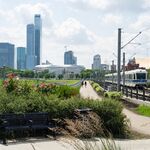
 
May I assume that the MUP on Victoria Park Road will become permanent as of next year? If so then when will the MUP on Sask Dr become permanent?
 
May I assume that the MUP on Victoria Park Road will become permanent as of next year? If so then when will the MUP on Sask Dr become permanent?

I would think this means Victoria Park Road will be permanent shared use path when this is constructed. There is some advocacy to make something permanent at Sask Dr, too.

I encourage anyone supporting that to send short and sweet email letting city know you're happy to see plan for Victoria Park Rd and would like the same for Sask Drive. Done!

Here is email to city team

Active Transportation Implementation Acceleration <activetransportation@edmonton.ca>
 
Not fond of that gap between on 163 Street between 95 Ave - Stony Plain Road (or 95 Ave - 96A ave & 100 Ave - Stony Plain Road)...
Don’t worry, the glenwood renewal already is filling that gap! Same with 95ave from 163st to 178st by the 95ave renewal.

Only concern I still have is that 142st to 102ave connection for the west end. Especially in the winter, that’s a tough section.

And 178st from 95ave to 87ave is a major missing link. Randomly a very skinny sidewalk while north and south are MUPs. Not sure when that’s getting fixed?

Kingsway is a huge route. Especially for blatchford connectivity.

As I’ve said before though, really need to see the implementation to feel excited. 105ave downtown was a pretty big fail and 102ave in glenora is such an uncomfortable and high conflict route. 76ave and 106st were also poor builds for the sharp turns. Making winter riding, cargo bikes, and passing all super tough.

Hopefully lessons being learned?

Lessons were definitely learned on 106 st when you look at the new infrastructure as you travel further south - it's great. Raised sidewalks and bike path which gives a better active transportation experience - especially for pedestrians, and slows down vehicles.
 
New Map just dropped for the 2025-26 routes!

View attachment 568133

Green is 2025, Red 2026 - It'll be digging into this a bit more but it looks like it'l be easier to get out west/east/north which is all we can really ask for! Hope 2027 brings a better yellowhead crossing
Very interested in what the design for the 112 ave/82 st crossing will look like. I suspect if you are biking along 112th between highlands and downtown you will end up having to cross 112 twice, once at Borden park and then again when past the train line. Don't love that and I suspect many bike commuters will continue along the south side of 112th as they do now but am excited something is happening.
 
Very interested in what the design for the 112 ave/82 st crossing will look like. I suspect if you are biking along 112th between highlands and downtown you will end up having to cross 112 twice, once at Borden park and then again when past the train line. Don't love that and I suspect many bike commuters will continue along the south side of 112th as they do now but am excited something is happening.
It's a good question. Definitely should ask city's engagement team - they want feedback from people who use these routes.

Active Transportation Implementation Acceleration <activetransportation@edmonton.ca>
 

Whoever in the COE is reading this forum, it would be amazing to make this into a map of sorts along with fancy graphics so there's an easy to share infographic that informs people of the genuine growth in cyclists with the network. This chart is a great tool though still!


All in all, good numbers and anyone who actually spends a lot of time downtown and in the core can attest to the large amount of cyclists. Much more than what I remember in 2019.
 
Last edited:
I just did a two hour count as part of Velo Canada annual pedal poll.

It was from 4-6pm at 102 Ave and 110 street. Personal vehicles were all scooters since there are no cars at this location and Velo did not want scooters counted as bikes even though they share the same infrastructure.

Screenshot_20240604_180503_Gallery.jpg


That's 419 bikes/scooters using the bike lane infrastructure in 2 hours at this one location.
 
Last edited:
Gotta spread these stats because my god I am sick and tired of hearing complain about "useless bike lanes" when they're not even near the bike network or, even worse, live outside of Edmonton and keep spewing nonsense about city issues.
Yup.
A lot of our bike infrastructure is not exactly in highly visible locations for motorists so I don't think they have great awareness. And we also know when travelling at 50km/hr or more, you notice less and less around you.

As well, I was also impressed and a bit surprised by the pedestrian count. But a lot of people pass through this area. Overall, it was more than 1,000 people using active transportation in this one location.
 

Whoever in the COE is reading this forum, it would be amazing to make this into a map of sorts along with fancy graphics so there's an easy to share infographic that informs people of the genuine growth in cyclists with the network. This chart is a great tool though still!


All in all, good numbers and anyone who actually spends a lot of time downtown and in the core can attest to the large amount of cyclists. Much more than what I remember in 2019.
I like this chart below more for the monthly counts. Although, it's interesting, because most routes haven't seen huge growth the last 5 years. All the data is tainted due to pre vs post covid, so it's hard to have a true baseline. But even the last 3 years, many routes have stayed flat or even declined. Some of this could be due to more new routes opening and that spreading out the cyclists that used to all use 1 route, but i doubt that's a true reason. I just don't think the city has done a lot the last 7 years really other than 1-2 new paths/lanes a year as part of renewals and no major work around storage, incentives, or school programs.

Here's hoping the next 7 years we see a big climb with all the investments.

Secure bike parking at or near Rogers would be really nice. Does anyone know if there's a parkade where you can do this that's safe/monitored? An ebike rebate program federally would do wonders, especially for students. More transit integration is badly needed. Bike share would be incredible for upping usage.

Data: https://data.edmonton.ca/Monitoring-and-Data-Collection/Monthly-Bike-Counts-by-Location/gm5u-psbx

Great report on 10 ways to increase cycling in Canada: https://www.tcat.ca/wp-content/uplo...n-Canada-A-Guide-to-What-Works-2019-09-25.pdf
 
This is the start of the new intersection at 149 St and 102 Ave. I'm concerned at the seemingly lack of accessibility on the future sidewalk. It looks like the corner will be a bit of a obstacle course.
20240612_165921.jpg
 

Back
Top