Metro Line LRT | ?m | ?s | City of Edmonton

Anyone know how much land they need to buy for the Metro Line? Seems to me most of its approved route is along roads, through parkland and generally city-owned property
My guess would be between 129 and 132 Ave where the road is a bit tighter than the rest of the route currently.
 
Anyone know how much land they need to buy for the Metro Line? Seems to me most of its approved route is along roads, through parkland and generally city-owned property
Between 129 and 132 Ave is the main area, as stated, I wanna back that up but i can't find pictures lol.
I remember seeing a concept design somewhere (maybe on GEC's site? i couldn't re-find it) that showed the LRT coming down off the bridge in the Northwest corner of Grand Trunk Dog Park, and crossing to the West side of 113st. the street would be 2 lanes next to the tracks, with tracks on the West and road on the East. the Houses on the West side were all marked for removal, all the way along 113 st to that mini-frontage road that appears just south of 132 Ave. the tracks were going to replace the frontage road at that point, then continue into the much wider 113 north of the avenue. but yeah, there's 2-3 blocks of houses to be removed in that are alone.
I'm also speculating that there may be some extra land needed from parking lots, front yards, etc for relocated turning lanes, etc. We're seeing that a lot on VLW right now. the tracks are in the middle of the road, but the car space is spreading in all kinds of directions to create all the accesses and stuff the newly-divided road will need.
$20 million for all the land they need doesn't strike me as a huge amount, given the scope and length of the line.

1671383407712.png

1671383564148.png


1671383646428.png
 
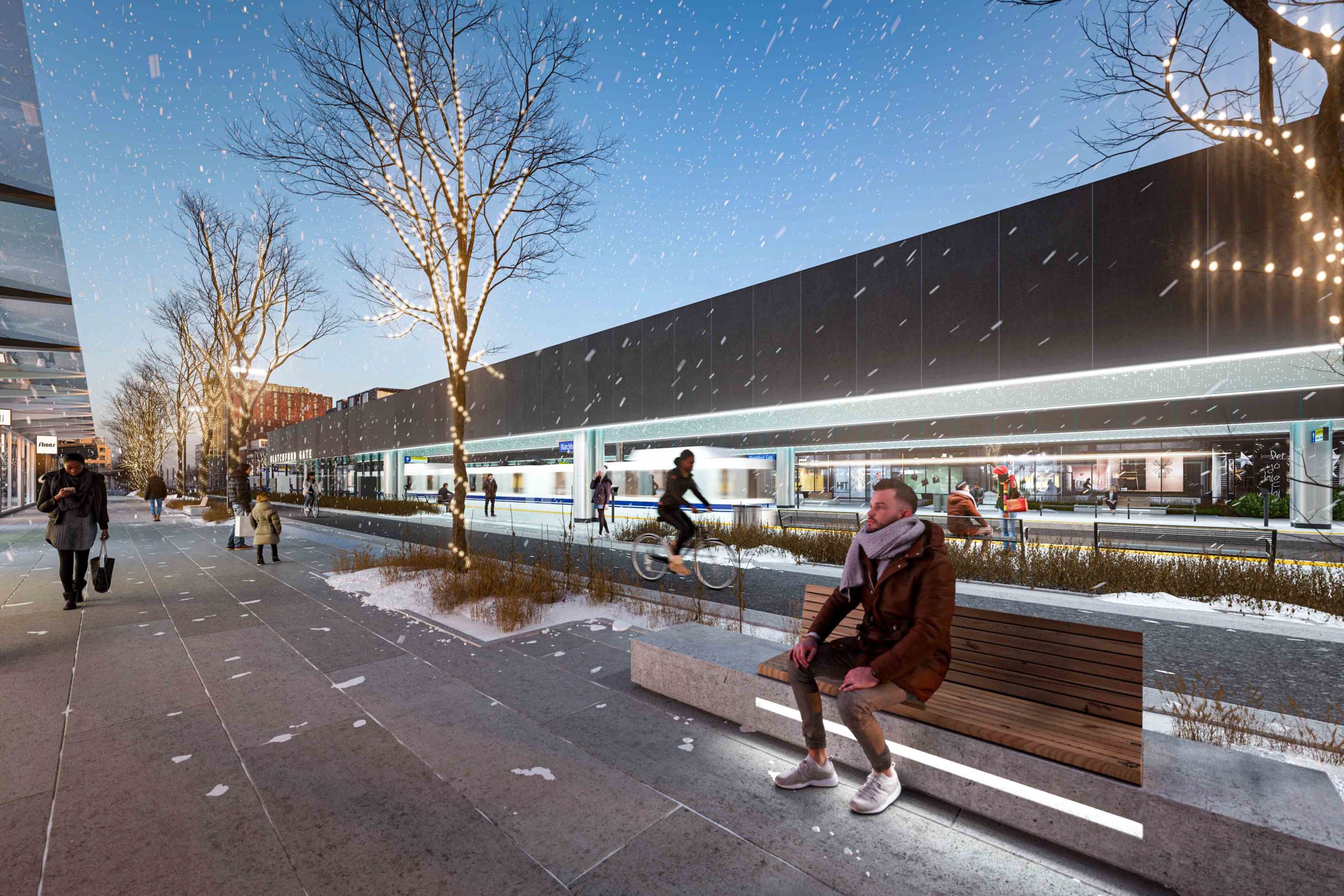
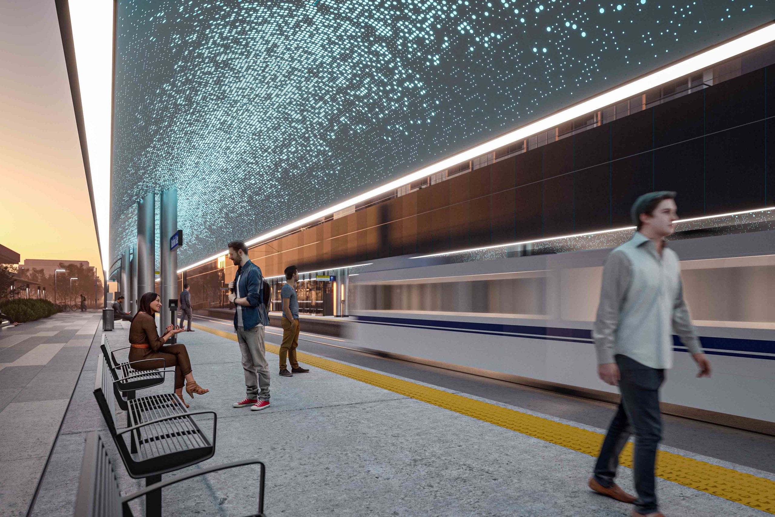
I'm genuinely so curious about the sparkly soffit. Do they have a product in mind? how will they keep it clean? is it some LED installation that fails after a couple years? overall I love what GEC has done with these stations, clean and simple. but that soffit ends up pulling so much design weight, and I'm worried the actual product will not look like that.
 
Likely an LED mat with simple perforated metal with a transparent dust cover or something.
 
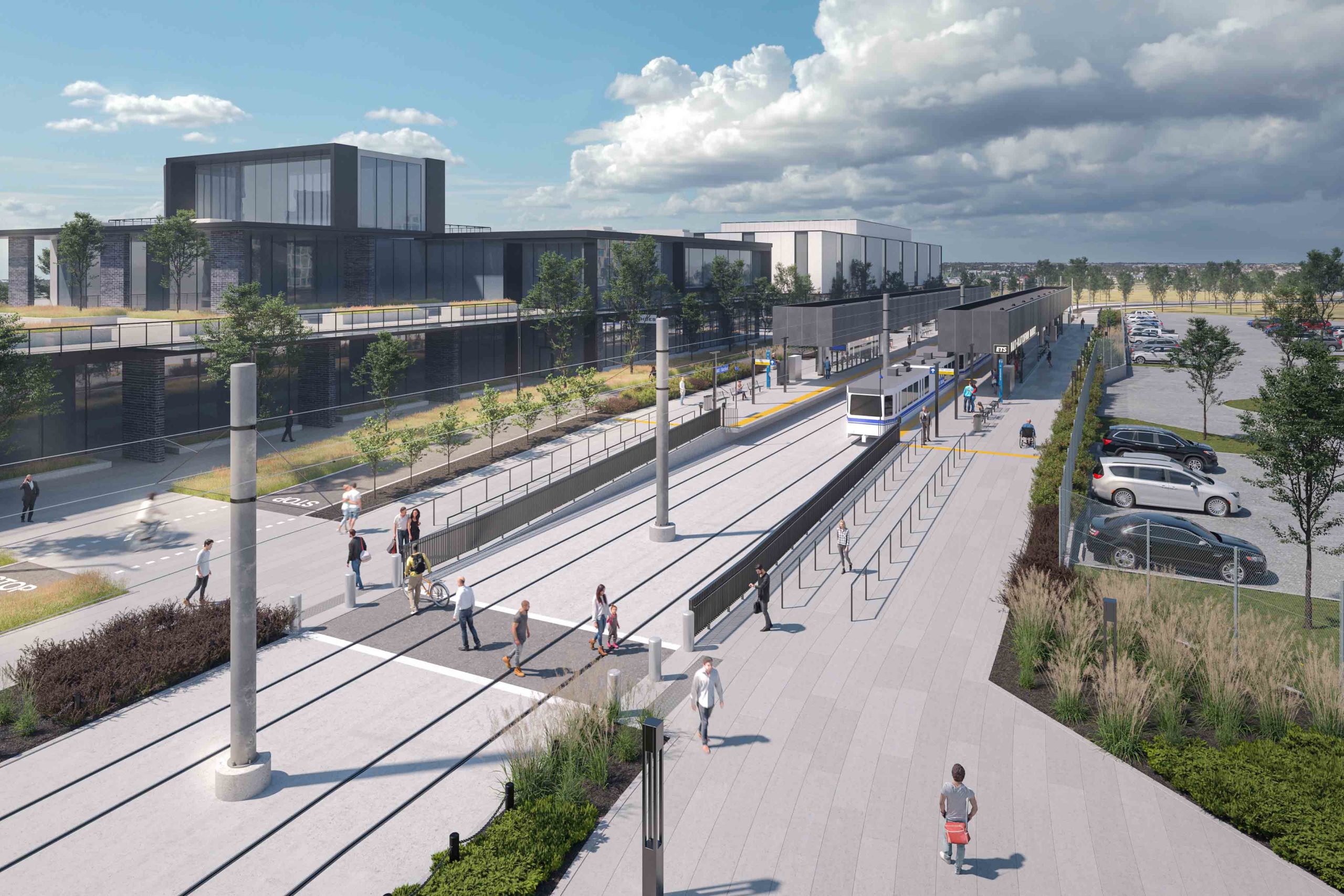
I find it a bit odd that GEC discusses the Metro Line Extension to Campbell Road but the pics only display what is currently under construction (i.e. as far as the Blatchford Gate station). When will GEC have pics of the rest of the line?
 
01-51-scaled.jpg


04-41-scaled.jpg


02-50-scaled.jpg


05-40-scaled.jpg


I would take these renders with a grain of salt, awesome that it is happening though!
 
The platforms and canopies look almost exactly the same as the rendering.
Anyone care to walk across Blatchford field to get some photos?
Was at kingsway last night and got these photos through the fence of the airfeild. The last photo shows the track is now connected to the existing line, with the existing caternary pole waiting to be removed. The rail looks continuous all the way to NAIT station.
The last time i was in Blatchford (a couple weeks ago) it looked like the Blatchford station was a bit behind the NAIT one, in terms of completion. The track, caternary, and adjoining road must be close to complete too. A forest of fire hydrants line the line, I’m assuming that means underground trunk lines for adjacent properties are also in place, to allow for future development. I think it’s coming along!
Side point, it looks like the curved soffits of the station roofs are mostly framed in. I couldn’t get close enough to see clearly, but it looked like slats were going in.
D73F0E78-6277-4296-BB8E-84D954F9992A.jpegDE9E8CA0-B8CC-4CBD-B395-D5514E091B9A.jpegDD478B18-F246-4DA6-BEF1-0D4466E70B10.jpeg
 
Was at kingsway last night and got these photos through the fence of the airfeild. The last photo shows the track is now connected to the existing line, with the existing caternary pole waiting to be removed. The rail looks continuous all the way to NAIT station.
The last time i was in Blatchford (a couple weeks ago) it looked like the Blatchford station was a bit behind the NAIT one, in terms of completion. The track, caternary, and adjoining road must be close to complete too. A forest of fire hydrants line the line, I’m assuming that means underground trunk lines for adjacent properties are also in place, to allow for future development. I think it’s coming along!
Side point, it looks like the curved soffits of the station roofs are mostly framed in. I couldn’t get close enough to see clearly, but it looked like slats were going in.
View attachment 461672View attachment 461673View attachment 461674
Thanks for the update. This is what the website says:

The extension is anticipated to open in 2025. Construction work for 2023 will include:

-Work on the interiors and exteriors of the NAIT and Blatchford Utility complexes.

-Work on the unique “transit mall” in Blatchford which includes a pedestrian sidewalk and commuter cycle track running adjacent to the LRT tracks.

-Installation of solar panels at the NAIT and Blatchford Stations

-Installation of the remaining Overhead Catenary System poles that will supply power to the trains.

-The installation of LRT signals, traffic signals, sidewalks, Shared Use Path (SUP), and landscaping.
 

Back
Top