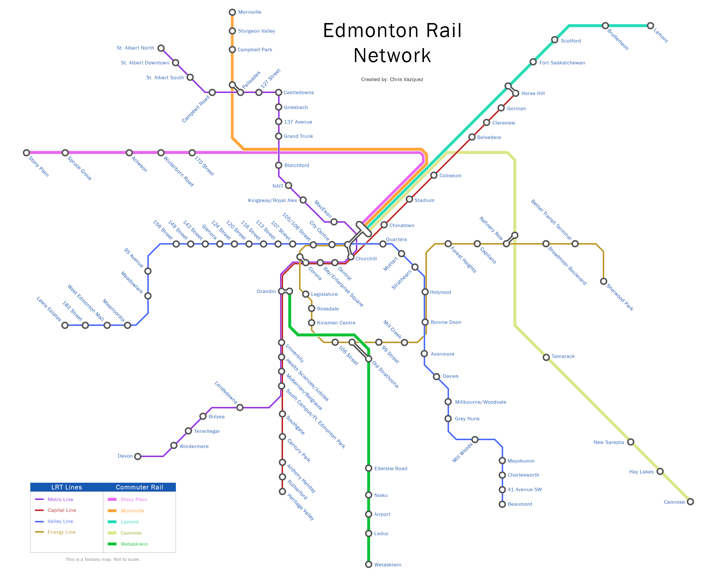
Made a fantasy map for the LRT recently. I included a SW branch of the Metro Line that splits from the Capital Line at South Campus, serves the Riverbend and Windermere areas along Terwillegar Drive and then swings west across the river to serve Riverview, which I've always thought was way too isolated from the rest of the city. I also changed the Festival Line to split off the Valley Line east of Misericordia, travel down 87 Ave, go under Parkdale and across the river and continue on to Whyte Ave. I know there's been lots of controversy about LRT in that area in the past but I'm hoping that low-floor LRT, with its mitigation of boom gates and better neighbourhood integration, will be more palatable to the residents there. I also the Whyte Ave portion should be underground cause there is way too much pedestrian and vehicle traffic in that area to build reliable surface LRT. The Festival Line also goes to Sherwood Park. Initially, I was thinking of sending the LRT straight down Baseline Road to Highway 21 but I changed it to travel down to Festival Place instead, cause that area is full of high-density development now.
Also why isn't my pdf file showing up?